
Where the data comes from

Click the ? icon next to any filter to see where that dataset comes from and how often it is updated.

See points of interest on the map

In the Points of Interest panel, choose the points of interest you want, such as Transport, Educational Institutions, Eating And Drinking, Supermarket Chains and Health, or tick Select All. Then click Apply. Pins drop on the map, each with an icon that shows what the point of interest is. The Point of Interest legend on the map shows the colour for each category, and the results are listed under Matching records.
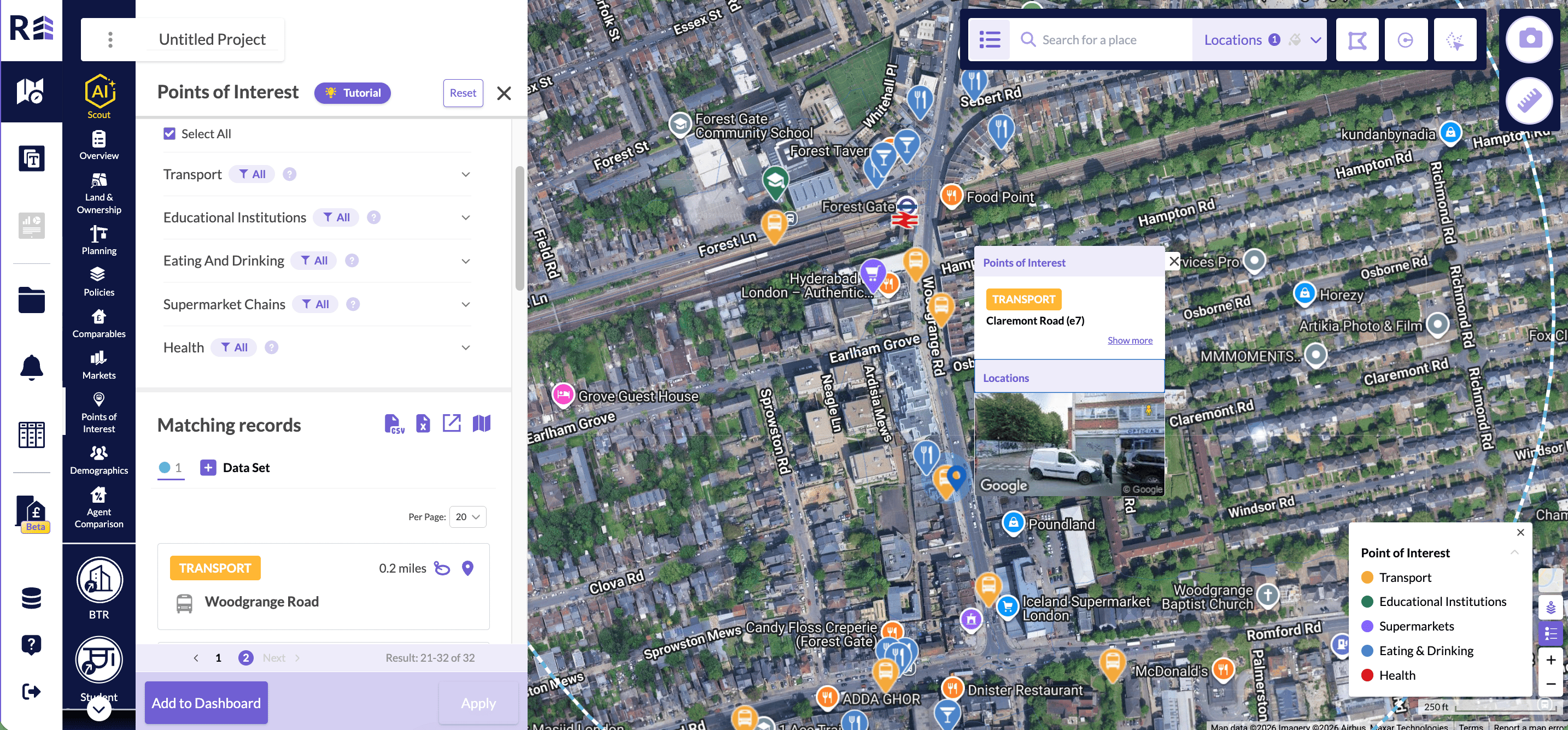
Points of Interest panel with categories selected, coloured pins on the map, a Point of Interest legend and a list of matching records

Points of interest pins on the map, with the legend and matching records.

If you do not see the pins, zoom in further.

Measure the distance between two points

You do not need to draw a circle and save it as your location. Click the ruler icon to measure the distance between two points on the map. Then click the camera icon to take a screenshot, so the distance is recorded in your dashboard.

Export points of interest

Run your search, then click the downward arrow icon to download the points of interest in your search location. The data downloads as an Excel file to your downloads folder.